

Kullu
Under an architect's lens
How a temple town on the Beas became a ribbon along a highway — read through its streets, its grain and its edges.
Where
The town in a few lines
- Valley
- The Kullu Valley, on the Beas
- Between
- Manali and Mandi
- Coordinates
- About 31.96° N, 77.11° E
- Road
- NH-3 (earlier NH-21), Chandigarh – Manali
- Built in
- Kath-kuni: timber and stone, laid in layers
- Today
- A tourism and cultural hub
Origin
Kulant Peeth
An ancient settlement known as Kulant Peeth — the end of the habitable world. It grew along the trade routes of the Beas, with deep roots in temple culture and mythology, and was shaped by three forces: agriculture, pilgrimage and, later, tourism.
Growth
From river settlement to ribbon
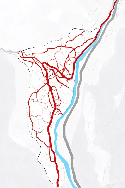
Kullu shows a linear-ribbon form: the valley leaves it nowhere to grow but along the road and up the slopes.
- Traditional
A river settlement
Clustered villages beside the Beas, growing organically; people moved on foot.
- Colonial
Roads and administration
New roads connected the valley, and the town took on an administrative structure.
- After independence
Growth along the highway
Tourism drove expansion, and the town began to stretch along the highway.
- Today
Ribbon development
Building spreads along NH-3 and up the slopes to the periphery: hotels, resorts, scattered informal growth.
Figure-ground
Fine grain, uneven texture
Drag across the town: the street network alone, then every building drawn. The grain is fine and uneven — dense in the old core, loosening towards the edges.
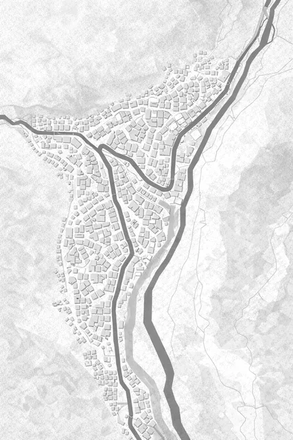
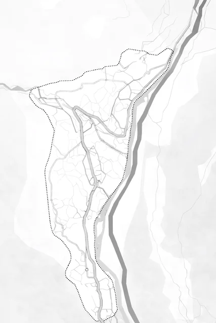
Image of the city
Landmarks, nodes and edges
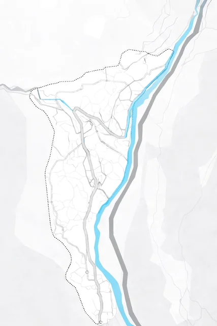
The places that make Kullu legible: what people steer by, where they gather, and the lines they cannot cross.
- Landmark
- Node
- Edge
Pin positions follow the original study sheet.
The temple at the heart of the old town and of Dussehra — the organic core grew around it: dense, narrow streets, homes over shops.
The main public hub, where the highway meets the town's lanes and most visitors arrive.
The open ground that fills with the valley's deities every Dussehra; the one large open space in a tight town.
A minor landmark, part of the institutional band beside the ground.
Where the town meets the Beas. The river is a strong edge: it divides movement as much as it draws people to it.
The Chandigarh–Manali highway is Kullu's spine — and the reason it grows as a ribbon along the valley.
Building in the valley?
Tell us about the site and what you want to build. We reply within a working day, usually on WhatsApp.
- We call youA short conversation about the brief and the site.
- We walk the siteLevels, light, the trees worth keeping.
- We send a proposalScope, stages and fees, in writing.
- Call
- +91 62306 73536
- Studio
- Bhuntar, Kullu, Himachal Pradesh
- Hours
- 9 am – 6 pm